


As wildfires drive hundreds of thousands from their homes across France and Spain, scientists warn a rare storm born from the flames themselves could make this summer’s crisis even harder to control.
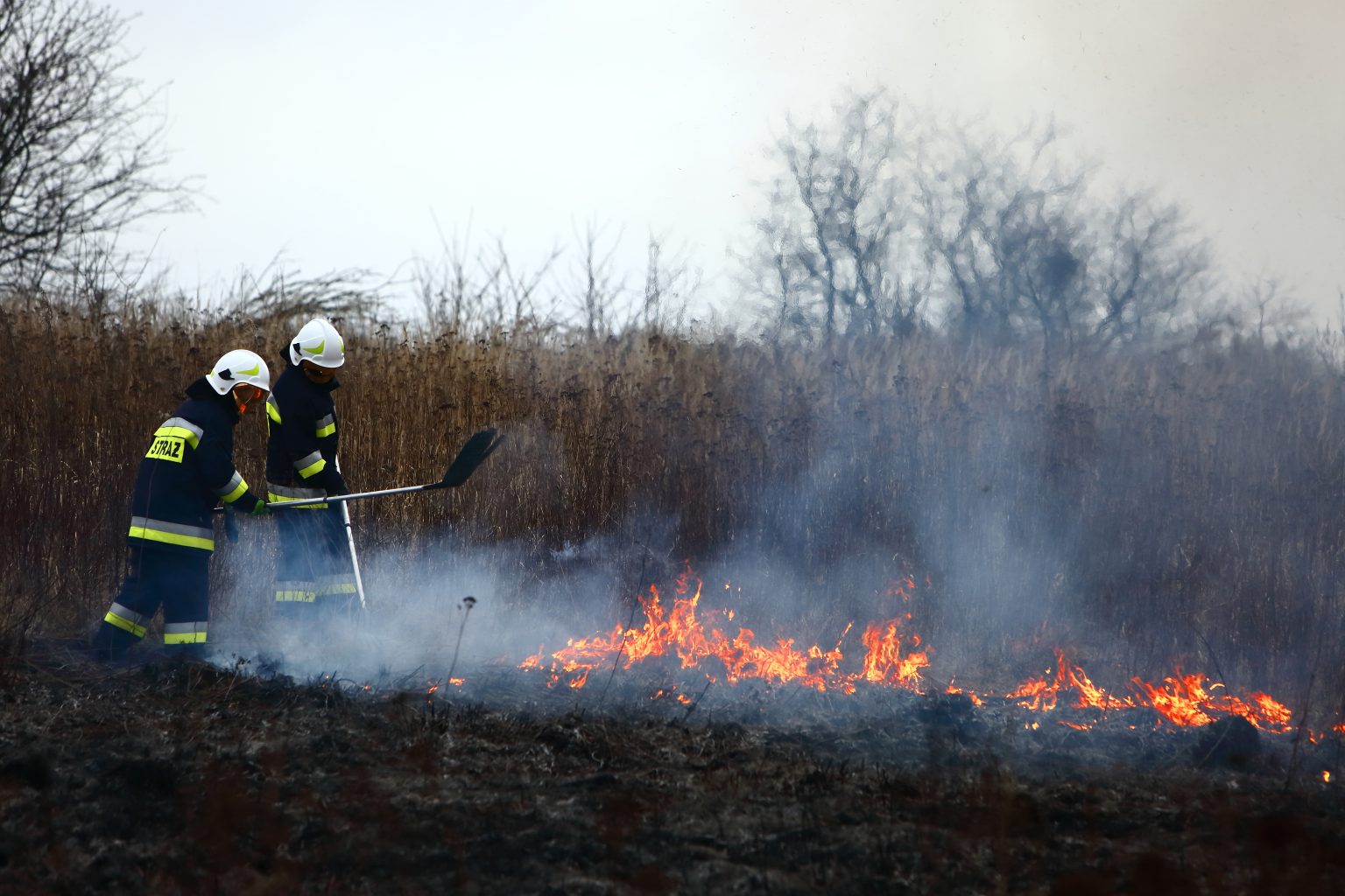
Firefighters in southwest France are no longer just battling flames racing across the ground. They are now watching the sky above the fire itself, waiting to see whether the blaze near Bordeaux produces something French emergency services have never had to confront before, a thunderstorm born entirely out of the fire’s own heat. Known technically as pyrocumulonimbus, or pyroCb, these towering storm clouds have earned the nickname the fire breathing dragon of clouds from American space scientists, and this week they moved from an obscure entry in atmospheric science textbooks to a live concern for officials trying to protect a major European city.
The science behind them is dramatic but straightforward once explained. A sufficiently intense wildfire releases enormous amounts of heat and energy, sending a column of hot air, smoke and ash rocketing upward. As that plume climbs into the atmosphere, falling pressure causes the rising air to expand and cool rapidly, and the moisture it carries condenses into a towering, mushroom shaped storm cloud, in effect a thunderstorm that the fire has built for itself. Once formed, a pyroCb behaves like any other severe storm, generating its own lightning, wind and sometimes even smaller tornado like vortices, except this storm sits directly above an active wildfire and feeds back into it in ways that make the fire’s behaviour almost impossible to predict.
That unpredictability is precisely what worries the officials fighting the blaze outside Bordeaux. A spokesperson for France’s national firefighters federation described the difficulty in stark terms, explaining that unlike an ordinary fire, which tends to spread in a single, roughly conical pattern that crews can anticipate and work around, a fire cloud spreads in every direction at once and develops multiple separate fire fronts simultaneously. Fire crews cannot fight it directly, the spokesperson said, calling it a David versus Goliath contest between exhausted ground teams and a storm system the fire has generated on its own. The intense updrafts and downdrafts inside these clouds produce sudden, violent wind gusts capable of throwing embers far beyond the main fire line and abruptly reversing the direction flames are travelling in, while dry lightning strikes can ignite entirely new spot fires kilometres from where crews are working, forcing them to abandon carefully planned containment lines with almost no warning.
What is a ‘fire cloud’?
If confirmed, scientists say this would be the first time a pyroCb has ever been recorded over French territory, a milestone that experts describe less as a curiosity and more as a signal of how far conditions have shifted. One researcher who studies the phenomenon noted that the immediate question is not really whether a fire cloud formed a few days ago, but whether one is likely to form over the coming days as the blaze continues to burn and a fresh heatwave arrives later this week. Pyrocumulonimbus events were first properly documented in Australia at the turn of the century and have since been recorded over intense wildfires in the western United States and Canada, including a notable cluster during California’s 2022 fire season, but Western Europe has seen very few genuine examples, with one of the earliest recorded instances occurring during a devastating Portuguese wildfire in 2017 that produced a smoke column roughly thirteen kilometres high before it eventually collapsed. Researchers studying the broader phenomenon note that these storms can inject huge quantities of smoke particles directly into the stratosphere, on a scale sometimes compared to a volcanic eruption, with effects on atmospheric composition that can persist for months and, some scientists warn, potentially slow the ongoing recovery of the ozone layer.
The scale of what has driven France and Spain to this point is itself striking. More than three hundred thousand people have been forced from their homes across the two countries, according to reporting from the ground, with the largest French blaze, in the Gironde region around Bordeaux, having burned an area roughly four times the size of Paris since it took hold last week. President Emmanuel Macron ordered the military to mobilise as the fire tore through the southwest and edged towards the historic wine producing city, and by Monday he had convened a further crisis meeting of his cabinet, bringing together the interior, defence, health, transport and environment ministers as officials scrambled to coordinate the response. The mayor of Bordeaux said over the weekend that the fire remained at the gates of the metropolitan area, with flames at their closest point coming within some fifteen kilometres of the city, even as authorities reported the situation had turned broadly stable overnight, a fragile respite given forecasts of another heatwave arriving within days. Gironde authorities have gone as far as banning holiday camps for children and people with disabilities just as France enters its peak August tourist season, an unusually sweeping precaution that underlines how seriously officials are treating the risk of a sudden reversal.
Why Europe’s summer of fire keeps intensifying
Spain’s crisis has been at least as severe. One blaze west of Madrid, in the province of Ávila, has burned around fifty thousand hectares, making it the largest wildfire in recorded Spanish history according to the country’s environment minister, while a second cluster of fires further south has spread through scrubland and farmland, cutting dozens of highways and forcing tens of thousands of evacuations, with tens of thousands more ordered to shelter in place to keep roads clear for firefighters and the soldiers deployed alongside them. A specialist military unit that handles natural disasters has sent some fifteen hundred troops into the affected areas, a scale of mobilisation that reflects how far these fires have outgrown what civilian firefighting services alone can contain. Spanish officials have linked the severity directly to weather, noting the country endured three separate heatwaves between June and mid July that stripped moisture from the soil and left vegetation primed to burn, a pattern scientists say is becoming Europe’s new summer normal rather than an exceptional event.
That climate dimension is central to why fire clouds are now appearing where they never used to. Researchers who study the phenomenon stress that rising global temperatures are not simply turning up a single dial, but are reshaping the broader mix of heat, dryness and atmospheric instability that allows both mega fires and the storms they generate to form in the first place. Warmer average temperatures dry out vegetation earlier and more thoroughly each season, while more frequent and intense heatwaves create the unstable atmospheric layering that lets a fire plume punch high enough into the sky to trigger genuine storm formation, conditions that were once confined largely to Australia and parts of North America and are now reaching temperate Western Europe.
What happens over the next few days in Gironde will say a great deal about how prepared European governments actually are for this kind of compound disaster, one that combines a conventional firefighting emergency with a genuine meteorological hazard forming directly above it. If a confirmed pyroCb does develop over the Bordeaux fire this week, French authorities will be managing not just a wildfire but an unpredictable storm system capable of scattering embers and lightning strikes across a far wider area than current containment lines are built to handle, precisely as another heatwave arrives to feed the flames further. Even if this particular fire never produces a confirmed fire cloud, the fact that French officials and scientists are seriously discussing the possibility at all marks a shift in what European summers now demand, pushing civil protection agencies, militaries and meteorologists to plan jointly for extreme fire behaviour that, until recently, belonged to a different hemisphere altogether.